By Alan Brown
Llanstadwell parish, with its administrative focus at St Tudwal’s church, dates back to pre-Norman times; however, the town of Neyland has a much shorter history. Before the coming of the railway, the name ‘Neyland’ applied only to the houses on the banks of the waterway which was formerly known as Neyland Pill, but is now generally referred to as Westfield Pill. Brunel’s South Wales Railway destroyed this early settlement, while at the same time it gave birth to the modern town of Neyland that progressively expanded until it eventually absorbed its surrounding communities.
The evolution of Neyland, and the relative decline of Llanstadwell, can be graphically captured in a historic succession of maps that covers nearly five centuries. Some of the earliest charts that give detailed descriptions of Pembrokeshire are the work of Christopher Saxton, who produced a volume of maps covering the whole of England and Wales in the late 16th century.

This first map, dated c1580, is a crop from a much larger map covering the whole of Wales. Within our parish it identifies Llanstadwell itself and also Newton, a settlement that has now vanished.
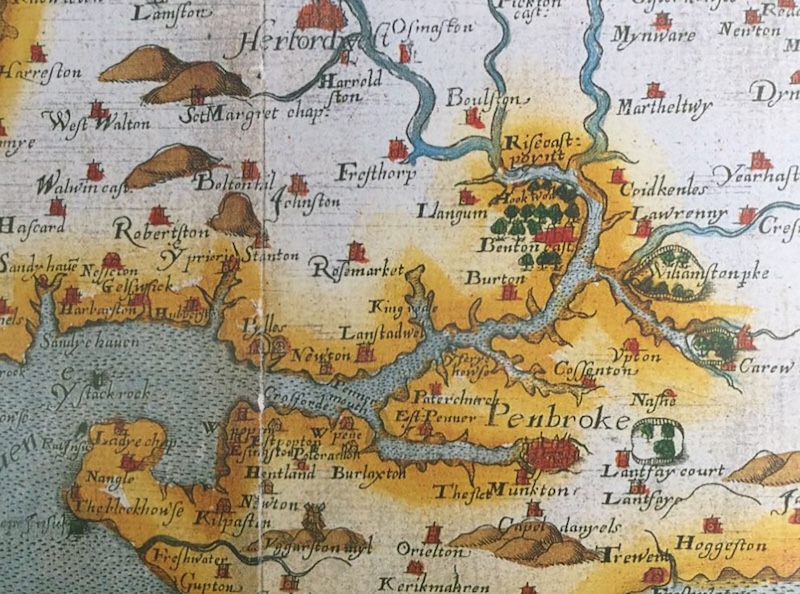
A larger scale map, also by Saxton, gives more detail.
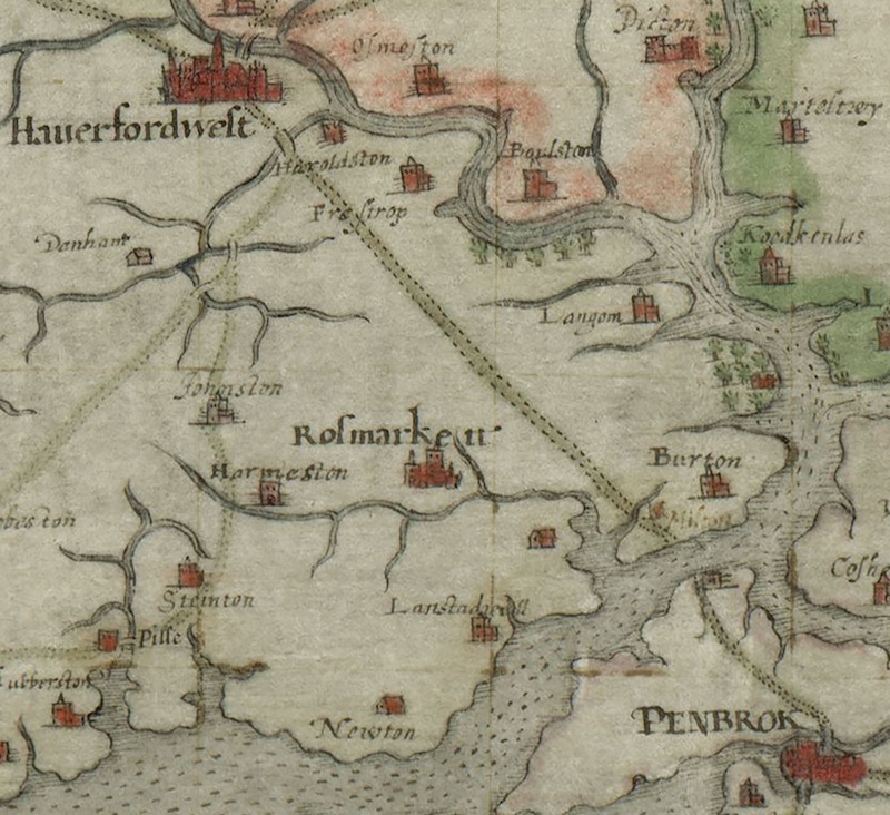
George Owen’s map of c1602 includes major roads; Llanstadwell was bypassed by the route that connected Haverfordwest to Pembroke.
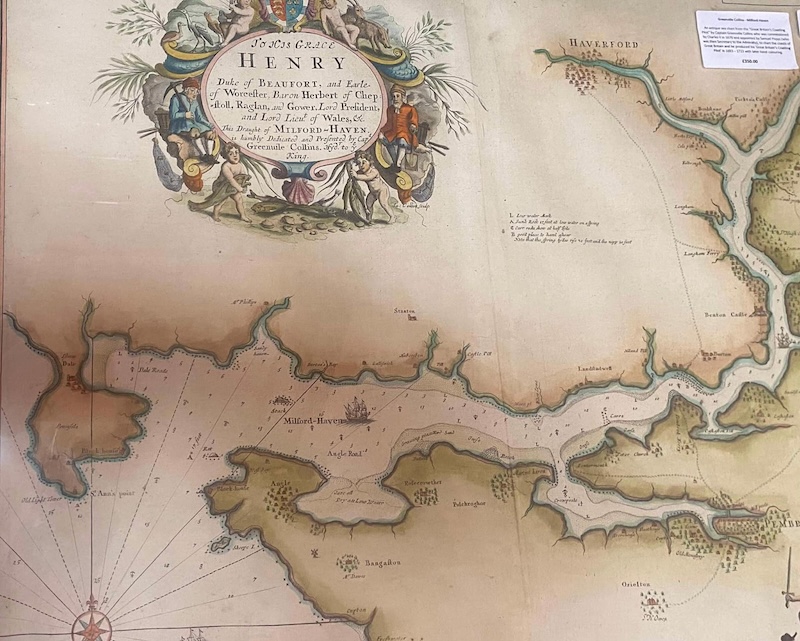
Grenville Collins’s map dates from around 1676. It is primarily a navigation chart of the Milford Haven waterway and gives little detail inland; however, it does identify Neyland Pill by name.
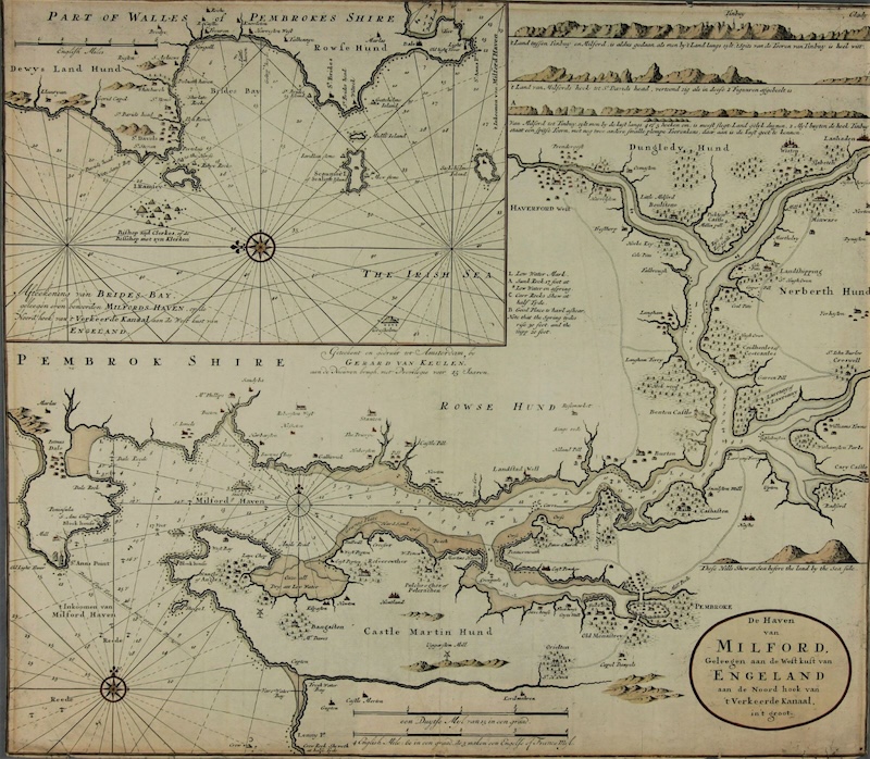
Van Keulen’s map of c1725 was likewise intended for navigation, but also marks the land route between the two major towns of Haverfordwest and Pembroke. At that time the Cleddau was crossed by ferryboat that worked between Burton Ferry (where the Jolly Sailor inn now stands) and the hamlet of Pembroke Ferry, which is now underneath the southern end of the Cleddau Bridge.
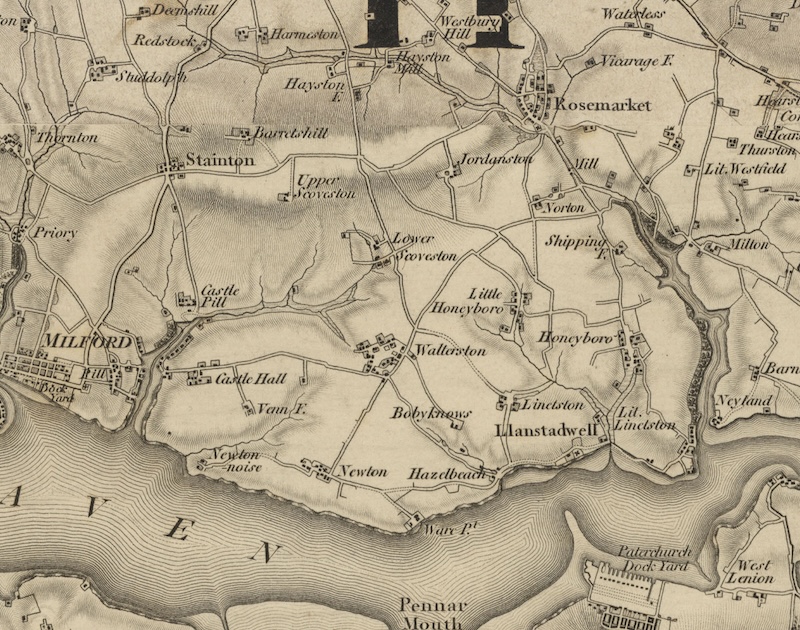
The first one-inch-to-the-mile Ordnance Survey map of south Pembrokeshire was published in 1818. This is the first map to give accurate detail of inland settlements and structures. It depicts the early community of Neyland, although the name, misleadingly, appears on the eastern side of the Pill. Honeyborough and Waterston were the largest villages in Llanstadwell parish at that time.
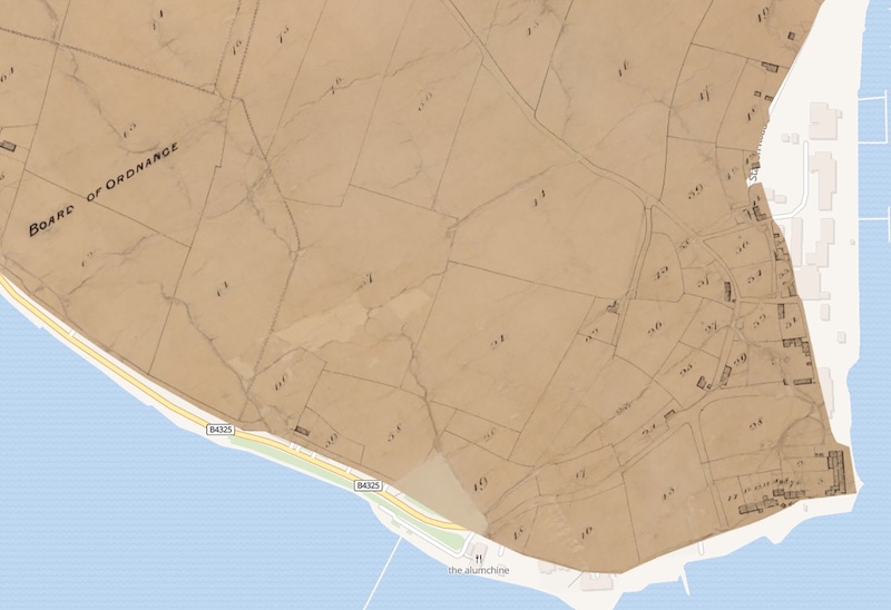
The tithe map of 1838 identifies individual houses and fields, while the accompanying text names their owners and tenants. Here it is superimposed on a modern-day map, showing how the foreshore had to be raised and extended to accommodate the arrival of the railway and the construction of the Promenade road.
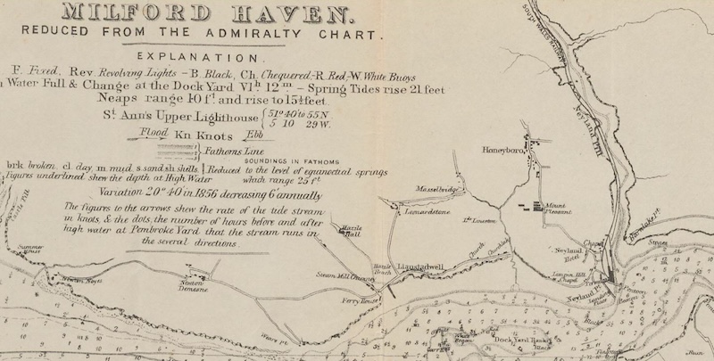
Dated 1856, this Admiralty chart illustrates the early development of the new Neyland in the years immediately following the opening of the station. The houses along Neyland Pill had been demolished, with many of their inhabitants moving up to the new community of Parryville (here marked as Mount Pleasant; now known as Charles Street and James Street).
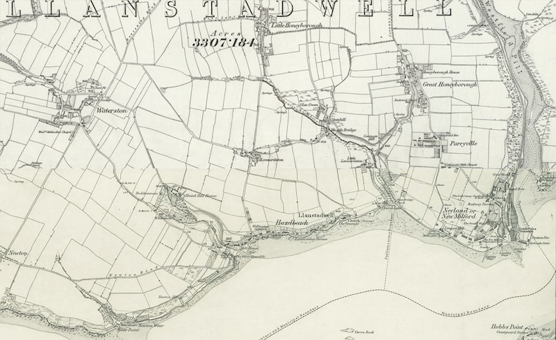
1868 Ordnance Survey six-inch-to-the-mile map. Close to the station, commercial establishments had sprung up for the benefit of rail passengers; here we see evidence of the railway company’s ultimately futile attempt to christen the town as ‘New Milford’. This caused a lot of confusion and pleased nobody.
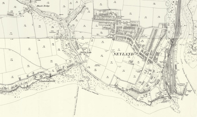
By the time that this large-scale map was published in 1900, a major house-building program had proceeded, heading uphill from the station. Neyland reached its economic peak in the years before the First World War: the Great Western Railway was a major employer, as was the Royal Naval Dockyard over the water in Pembroke Dock, with many of Neyland’s men commuting to work on the ferry.
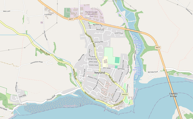
Neyland was severely affected by the combination of inter-war economic depression and the closure of the Naval Dockyard. There was little further housing development until the years after World War II, when a large estate of municipal housing was built on the open fields between the High Street and the Prom. Another large-scale program of house-building began in the 1970s on land to the east of Kensington Road and Honeyborough Road. The station had ceased to operate with the Beeching cuts of the early 1960s, while the opening of the Cleddau Bridge in 1975 made the ferry service redundant overnight. The most recent map, above, illustrates the fact that Neyland has, once again, been bypassed by the principal route across the Milford Haven waterway and, with its major employers long gone, has settled into the status of a quiet dormitory town.
Ordnance Survey maps are reproduced with the permission of the National Library of Scotland https://maps.nls.uk/
Tithe maps are available from the National Library of Wales on https://places.library.wales/